Odisha cyclone News
Recalling cyclone Fani, which hit the Odisha coast on May 2, 2019, Patnaik said determination of the path of cyclones during summer is difficult.
The Southwest Monsoon is set to arrive early with the Andaman and Nicobar Islands expected to receive first seasonal showers on May 15.
IMD has issued a yellow alert, warning of a heatwave at most places in the capital on Friday and Saturday.
Cyclone Asani has further weakened to a depression.
Several parts of Odisha and West Bengal are bracing for heavy rain as severe cyclone Asani weakened to a cyclonic storm yesterday.
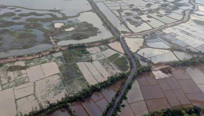
Many districts along the Bay of Bengal coast witnessed moderate to heavy rain.
The highest temperature in Delhi has touched around the 40-degree mark on Wednesday while the minimum temperature on the other hand settled at 28 degrees Celsius, reported PTI quoting IMD.
IMD predicted a heatwave for three days in Delhi and adjoining areas this week.
Light to moderate to rainfall is likely in coastal Odisha and adjoining areas of north coastal Andhra Pradesh.
Rainfall and gusty winds are very likely over Northeast India during the next five days.
The severe cyclonic storm is located around 450 and 500 km south of Visakhapatnam and Puri.
The Met Office has predicted heavy to very heavy isolated rainfall from May 10-11.
Some coastal districts of Odisha are expected to receive heavy rainfall from May 10 onward.
The term Asani has been suggested by Sri Lanka, which refers to 'wrath' in Sinhalese.
IMD notified that cyclonic storm ‘Asani’ will intensify further into a severe cyclonic storm during next 24 hours.
The officials have taken all precautionary measures to deal with the possible situation.
Low pressure has converted into a depression located almost 1,300 km from southeast of Puri.
Rainfall is expected in Gajapati, Ganjam and Puri in Odisha on May 10 and 11.
Sea conditions near the Odisha coast will become rough on May 9 and rougher on May 10.
IMD informed that the Depression might turn into a cyclonic storm by Sunday evening.
A fresh spell of a heatwave is likely to begin over northwest India from May 7 and over central India from May 8.
The Low Pressure Area (LPA), formed over South Andaman Sea, is likely to intensify into a depression by today evening.
It will further intensify into a cyclonic storm by Sunday evening, predicts IMD.
Special Relief Commissioner said 17 teams of NDRF, 20 teams of ODRAF and 175 fire services teams have been put on high alert.
The rains and thunderstorms lashing the state over the last two days are due to nor'westers.
Collectors of 18 districts have been put on alert and asked to take all measures required.
IMD informed the Odisha government that a low-pressure area is likely to form over South Andaman Sea and its neighbourhood in the next 48 hours.
Odisha Special Relief Commissioner wrote to 18 district collectors in the state and asked them to prepare in advance to reduce the impact of the possible cyclone.
The system is very likely to intensify into a depression in the next 48 hours and move in the north-westward direction, Umashankar Das, Senior Scientist, IMD told ANI.
The changing weather has worsened the situation in many states of the country. Tamil Nadu, Chennai, and Kerala are also in bad condition. A cyclonic storm named Jowar is forming in Andhra Pradesh and Orissa.
As cyclone 'Yaas' appears set to make landfall on the Indian coastal region on Wednesday, 26 May, Odisha and West Bengal faced heavy rain ahead of its arrival.
The MeT Department has advised all establishments and markets to remain closed in the city and adjoining areas and restriction on movement of people on May 20.
Odisha govt is seeking help from foreign nationals and NRIs to rebuild the state after cyclone Fani ravaged it.
Singh added that work for the restoration of power infrastructure is being done on a war footing.
Loading...


)
)
)
)
)
)
)
)
)
)
)
)
)
)
)
)
)
)
)
)
)
)
)
)
)
)
)
)
)
)
